Trail Walking La Turbie - fort de la Revère - Photo
© OpenStreetMap contributors
Length
Length
8.6 km
Max alt
Max alt
699 m
Uphill gradient
Uphill gradient
284 m
Km-Effort
Km-Effort  
12.4 km
Min alt
Min alt
456 m
Downhill gradient
Downhill gradient
284 m
Boucle
Boucle
Yes
Creation date :
2024-10-05 08:22:17.476
Updated on :
2024-10-05 16:53:44.901

(0 Reviews)

Walking
Walking
2h41
Difficulty : Easy

Scan this QR Code to open this trail in the SityTrail application

FREE GPS app for hiking

Logo SityTrail SityTrail

IGN / Geographical institutes

Download SityTrail from the App Store Download SityTrail from Google Play

Logo SityTrail SityTrail Plus

The world is yours!

Download SityTrail from the App Store Download SityTrail from Google Play Download SityTrail on Huawei AppGallery

About

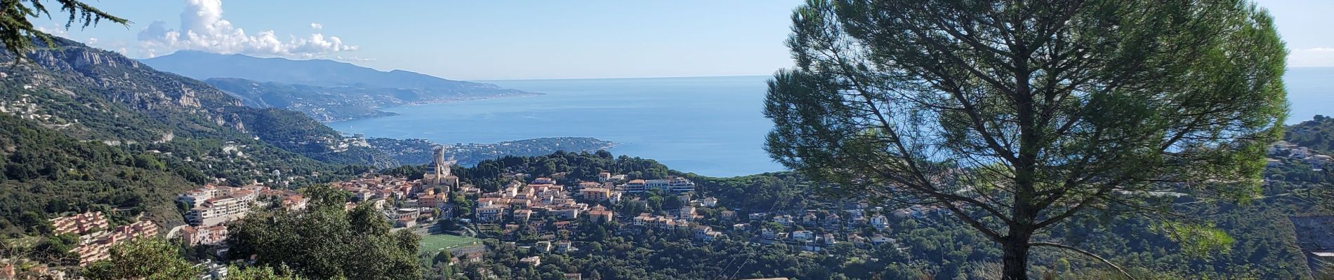
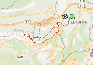
Trail Walking of 8.6 km to be discovered at Provence-Alpes-Côte d'Azur, Maritime Alps, La Turbie. This trail is proposed by TOULAUDIN.

Description

Départ de la Turbie ( petit parking ,il faut tenter sa chance.....ce que nous avons eu)c'était après beaucoup de pluie ,la montée est glissante.le retour est un sentier beaucoup moins spectaculaire
Il faudrait faire cette balade au soleil levant .il y a la maison de la nature à visiter.vue spectaculaire à l'aller sur toute la côte ; à ne pas manquer

Elevation profile

Photos

Positioning

Country:
France
Region :
Provence-Alpes-Côte d'Azur
Department/Province :
Maritime Alps
Municipality :
La Turbie
Location:
Unknown
Start:(UTM)
370726 ; 4844815 (32T) N.


Close
My subscriptions